The threat of wildfires is growing due to climate change, drought, and depopulation in rural areas. These fires not only destroy thousands of hectares of ecosystems but also impact communities, infrastructure, and the local economy. In this context, digitalization becomes a strategic ally: the use of satellites and drones is transforming how wildfires are prevented, detected, and managed.
Why Satellites and Drones?
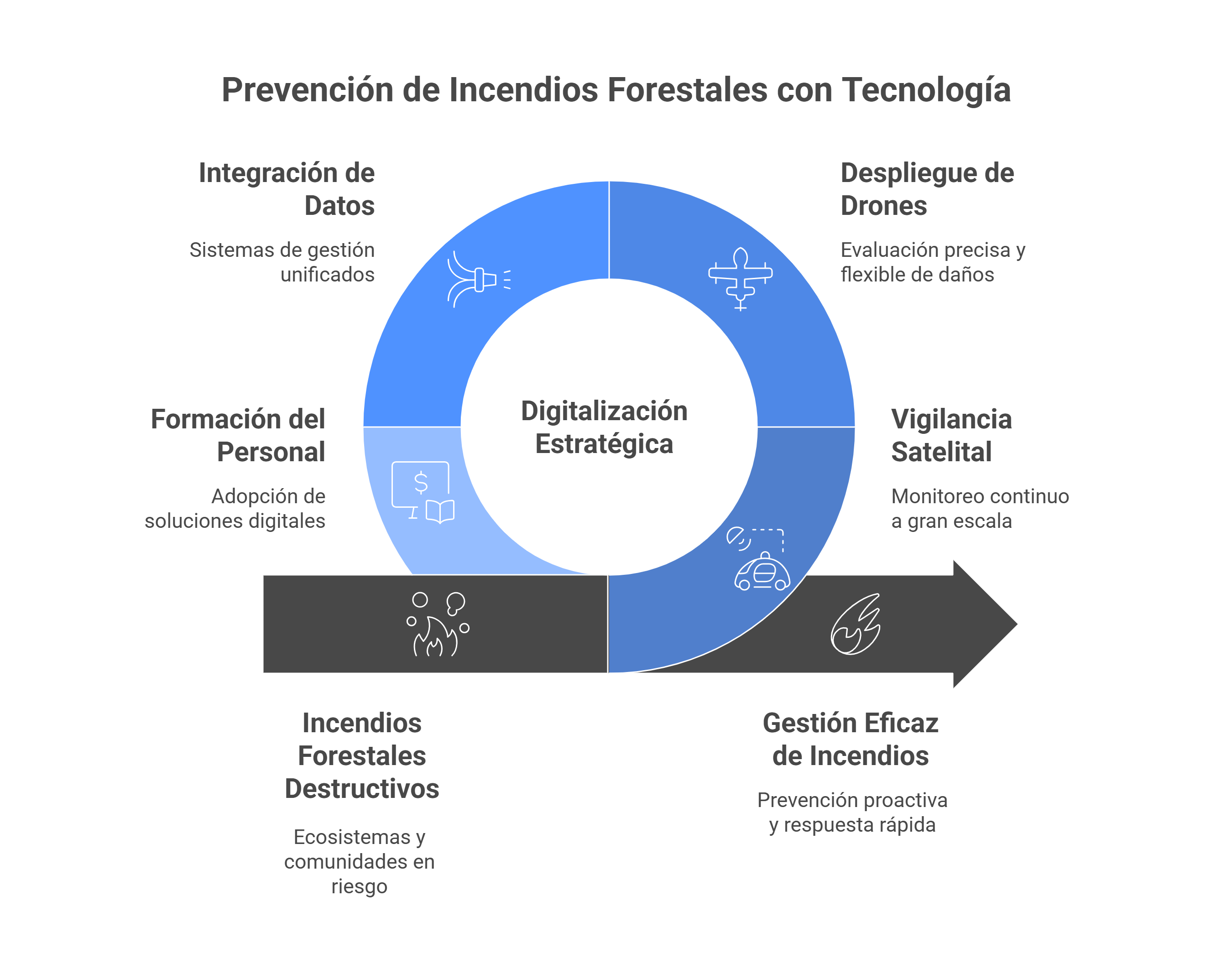
The choice of satellites and drones as key tools in the fight against wildfires is no coincidence. These technologies enable more efficient, continuous, and precise monitoring of the territory, facilitating early risk detection and rapid intervention. Their complementarity—global vision from space and local detail from the air—offers unprecedented coverage to protect our ecosystems.
Satellites: Provide continuous, large-scale monitoring with real-time imagery to detect heat sources, vegetation changes, and risk conditions.
Drones: Offer precision and flexibility. They can fly over critical areas, assess damage, locate hotspots, and support emergency teams in hard-to-reach locations.
Challenges for Businesses and Public Administrations
The adoption of these technologies presents significant challenges for companies and public administrations. From integrating data into unified management systems to overcoming technological barriers in rural areas, coordinated efforts are needed to ensure these solutions reach those who need them most. Staff training and promoting digitalization in SMEs and local entities are key to success.
Integrate data from multiple sources (satellites, drones, ground sensors) into unified management systems.
Overcome barriers to accessing advanced technology in rural areas.
Ensure staff training and the adoption of digital solutions in local organizations and environmental SMEs.
Benefits of Applying These Technologies
The use of satellites and drones in wildfire prevention offers multiple benefits. It enables proactive monitoring, improves emergency response capabilities, optimizes resources, and contributes to the sustainability of rural areas. These tools not only protect the natural environment but also strengthen community resilience to climate change.
Proactive prevention: Early identification of risk zones.
Rapid response: Precise location of hotspots and support in decision-making.
Cost reduction: Optimization of human and material resources in emergency management.
Sustainability: Conservation of natural heritage and rural environments.
Highlighted Use Cases
Various projects are already demonstrating the practical potential of these technologies. From systems that combine satellite imagery with artificial intelligence to predict risk zones, to drones capable of operating in extreme conditions, these use cases show how innovation can make a difference in territorial protection. These digital solutions are transforming emergency management and opening new possibilities for environmental conservation.
Monitoring systems that combine satellite imagery with artificial intelligence to predict high-risk areas.
Drones with thermal cameras capable of operating in low-visibility conditions.
Digital tools that generate real-time heat maps for security and civil protection teams.
How Does DIGIS3 Help You?
At DIGIS3, we bring these technologies closer to SMEs, midcaps, entrepreneurs, and public sector entities.
Digitalization not only protects our forests—it also opens new business opportunities in sectors such as environmental engineering, agriculture, and emergency services.
At DIGIS3, we work with you to make technological innovation your best ally in the fight against wildfires.